In UAV mapping, altitude truth is everything. A well-chosen laser rangefinder module stabilizes AGL, protects standoff to façades, and keeps overlap and exposure plans on track when GNSS or baro wander. This buyer’s guide explains how to select, integrate, and validate an LRF for UAV mapping so your team ships predictable missions instead of flying science projects.
Table of Contents
Toggle1) Start with the mission, not the spec sheet
Before you compare part numbers, write a one-line job statement for the aircraft you care about most. For example: “Down-look terrain following at 3–20 m AGL over brush,” or “Forward-look standoff 5–60 m for façade mapping.” That sentence determines the geometry you need, the update rate you must hit, and the way you’ll gate confidence for the flight controller. If you can’t state the job in one breath, you can’t meaningfully select a module.
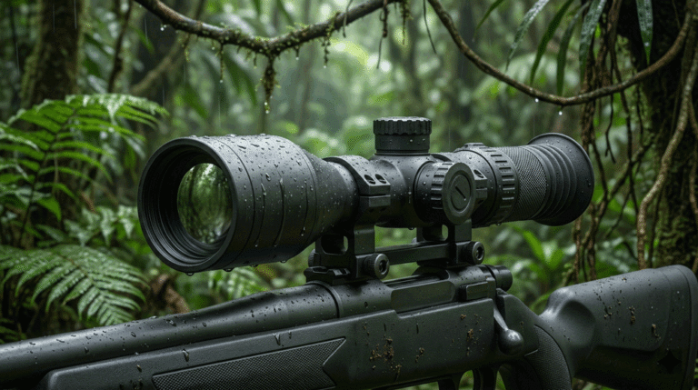
For down-look orthomosaics, the rangefinder behaves like a low-altitude altimeter near takeoff/landing and over variable terrain. It prevents AGL drift that would otherwise break ground sample distance (GSD) budgets and forward/side overlap. For façade/tower mapping, the LRF is a standoff governor as the aircraft creeps toward walls, cranes, or blades; it provides “truth” where stereo disparity gets sparse and SLAM may drift. Under-canopy or mixed-terrain work needs multi-return capture and logic that prefers the closest stable cluster so twigs don’t win over ground.
Internal link to the technical core: Laser Rangefinder Module
2) Geometry that actually determines field behavior
2.1 Beam divergence (H×V, mrad)
Divergence is the far-field angular spread of the laser; the spot diameter (m) ≈ divergence (mrad) × distance (m) / 1000. That single relationship governs whether you “paint” just the surface you care about or also the background behind it.
- Down-look altimetry: a slightly elliptical beam, around 2.0 × 1.2 mrad (full-angle, H×V), reads steadier during flare and pitch while keeping the footprint tight on grass, gravel, or pads.
- Forward-look standoff: choose ~1.5–1.8 mrad full-angle so the footprint stays within panels or tower members and doesn’t bleed onto sky through gaps.
Use one vocabulary everywhere—full-angle 1/e² unless you explicitly state FWHM. Mixing half-angle or FWHM across vendors will corrupt every comparison you try to make.
2.2 Receiver field of view (FOV)
The receiver FOV must roughly envelope the laser footprint at working ranges. If FOV ≫ spot, you integrate clutter (sky behind rails, windows behind mullions) and the controller sees a noisy average. If FOV ≪ spot, you “fall off” the sensing cone during maneuvers. Matching FOV to spot fixes more field issues than late-stage firmware ever can.
2.3 Measurement range and surface reflectance
A heroic “max range on 80% reflectivity” tells you little about mapping. Ask for a range vs. reflectance card at incidence angles you will fly (nadir, 30°, 45°). Asphalt, concrete, painted façades, and brush behave differently. Modules with transparent test methods and scene notes (e.g., “rough stucco, 25% reflectance, 30°”) are easier to design around than ones with just a headline number.
3) Signal chain and timing: what flight controllers “feel”
A mapping-ready laser rangefinder module couples good optics with a low-noise detector front-end and produces distance + strength + confidence at a predictable cadence. Three regimes matter:
- Bright sun, hard targets: returns are strong but glare and stray light can spike the baseline; good baffles and AR windows matter as much as algorithms.
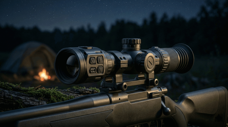
- Dusk and brush: ambient NIR drops (helpful), but faint glints from leaves increase (harmful). Thresholds must adapt to ambient so false positives don’t climb as light falls.
- Obliques near façades: the beam sees slivers of sky or far backgrounds through gaps; without closest-cluster bias, the stream will “range through” handrails or edges.
Latency is as important as SNR. The controller can only act on what it knows now. Budget <100 ms end-to-end (sensor → UART → companion → MAVLink → FC). Anything older should be flagged “not valid for control” or dropped.
4) Interfaces that plug in cleanly
MAVLink is the lingua franca for PX4/ArduPilot ecosystems. The cleanest integration publishes DISTANCE_SENSOR/RANGEFINDER at ≥10 Hz (20 Hz preferred for close approaches), includes a covariance or confidence field, and provides a health heartbeat to let the FC fail-safe when data goes stale. The module should still expose UART for deterministic command/telemetry and USB for firmware updates and flight-log extraction. If you feed a companion computer, keep a sample-age field in the message so your planner, logger, and camera trigger can reason about time alignment.
5) Down-look vs forward-look: practical playbooks
5.1 Down-look altimeter (terrain follow, takeoff/landing)
Mount the module in a down-look orientation with a footprint matched to the expected flare height. Use the ~2.0 × 1.2 mrad H×V starting point and size FOV accordingly. Avoid self-occlusion from legs, landing gear, or UGV clamps—offsets are fine if you measure and store the lever arm. In the controller, gate “valid for control” by confidence and age, and tighten range-gate width below ~5 m so brush and low bushes aren’t misinterpreted as ground. Cross-check with baro and GNSS; prefer laser near ground.
5.2 Forward-look façade standoff
Co-boresight the LRF with the EO/thermal gimbal and calibrate extrinsics so range overlays align with crosshairs in your GCS. Choose ~1.5–1.8 mrad divergence and a tight FOV. Implement multi-return capture with closest-cluster selection and short temporal confirmation (N-of-M frames) before treating the number as truth for control. Pilots understand confidence-coded ribbons better than raw numbers; present both range and “good for control” status clearly.
For fused perception (thermal + range to subject), see Thermal camera module. It layers well with the LRF for night inspection and SAR.
6) Camera timing, boresight, and reconstruction
Range helps mapping because it stabilizes AGL and, in façade work, removes doubt near approach. To exploit that, you need clean timing:
- Time base: use the autopilot’s monotonic time or GPS time across camera trigger and range stream.
- Rolling shutter: keep range latency below ~100 ms and record age-since-sample; otherwise, the camera believes it shot at a different height than reality.
- Boresight & lever arm: the measurement origin is not the camera origin. Measure (x, y, z) and rotations in the body frame, store them with the bundle, and keep them in the log. Tiny mistakes here balloon into reconstruction errors.
7) Environmental and mechanical details that matter more than you think
Windows take a beating. Recess them and use AR coatings; provide a simple cleaning SOP for field crews. Vibration at prop fundamentals and harmonics can couple into the detector chain; isolate accordingly. Cable routing should protect against throttle-induced brown-outs and avoid shadowing Remote-ID or telemetry antennas. Above all, write boresight retention into your SOP—keyed mounts, torque specs, adhesive stackups, and an alignment check after thermal cycles and transport. A perfect calibration on the bench is worthless if the bracket creeps in the van.
8) Selection table (illustrative targets—tune for your airframe)
| Mission type | Suggested divergence (full-angle) | Receiver FOV | Effective range window | Why it works |
|---|---|---|---|---|
| Down-look terrain follow | ~2.0 × 1.2 mrad (H×V) | Envelope spot at 3–15 m | 1–30 m | Flare stability; brush tolerance |
| Auto-land / pad capture | ~1.5–2.0 mrad | Tight at 1–5 m | 0.7–10 m | Precise footprint near touchdown |
| Forward-look façade | ~1.5–1.8 mrad | Tight at 5–40 m | 5–60 m | Avoids background bleed at obliques |
| Under-canopy crawl | ~2.0 mrad | Match at 2–8 m | 1–20 m | Multi-return + closest-cluster logic |
Treat the table as a conversation starter. The right answer is the one that keeps your spot inside the surface that matters while giving pilots and controllers a stable, timely signal.
9) Validation you can hand to customers and auditors
9.1 Bench (repeatable optics math)
Build a two-distance NIR imaging jig—say 10 m & 30 m—with neutral-density filters. Capture beam profiles in X/Y, fit Gaussians, and report 1/e² full-angle divergence and axis ratio. Archive the plots per module serial in your QA folder. When emitters, lenses, or coatings change, the system tells you to re-verify automatically.
9.2 Flight tests (publishable one-pager)
Create a simple test card that procurement and operators both understand:
- Standoff approach: fly 40 → 5 m at 0.5 m/s and 1.5 m/s toward a panel; log range error vs. tape/total station, latency, and confidence.
- Terrain follow: descend over scrub; compare with baro/GNSS; report false-lock % and controller behavior at “valid for control” thresholds.
- Low-light: repeat during golden hour into civil twilight, dry vs. mist; demonstrate that ambient-aware thresholds keep false positives flat.
9.3 After-stress checks
Thermal cycle (−10 °C → +50 °C), dwell at prop fundamental + second harmonic, then re-verify boresight, divergence, and window integrity. Misalignment hides until the last mile; catching it here prevents embarrassing returns.
10) Safety, compliance, and the paperwork that shortens sales cycles
Treat compliance as part of architecture. Build your file to IEC 60825-1 Class 1 and, for U.S. market entry, organize labels and records according to FDA Laser Notice No. 56 (recognition of IEC conformance for laser products). Keep in a single revision-controlled packet:
- The AEL calculation worksheet for your actual pulse parameters and optics.
- Label artwork with wavelength and Class statement, matched to product photos.
- Test setups (divergence, output) with images.
- Change-control notes that trigger re-verification if emitter, optics, or coatings change.
Enterprise, public-safety, and utility buyers ask for this early. When it’s tight, pilots start sooner and legal reviews shorten.
11) Cost, schedule, and the bundle that actually saves time
Drone teams don’t want a loose sensor—they want a bundle that flies. A practical OEM kit should include the module, mounts and shims for common gimbals/airframes, a flight-rated harness (UART/USB) with pinouts, a sample MAVLink publisher with confidence gating, a boresight worksheet (lever arm & angles), and a QA pack (divergence plots, Class 1 worksheet, labels). Pilot kits usually land in 2–4 weeks; after first-article approval, SOP inside ~10–12 weeks is realistic if labels and test jigs are final early.
Start here: Laser Rangefinder Module
For fused night perception or hot-spot localization: Thermal camera module
12) Common pitfalls (and how to avoid them)
Spec drift via definitions. One vendor quotes half-angle, another full-angle; one uses FWHM, another 1/e². Pick one canonical language and enforce it across SOWs and acceptance tests.
Over-wide receiver FOV. If FOV dwarfs the spot, the system “averages” background and target, ruining façade standoff. Tighten the optics before you blame firmware.
Latency blindness. Controllers hunt when stale samples are allowed into the loop. Drop anything older than ~100 ms or mark it not valid for control.
Mounts that creep. A perfect calibration loses to a loose bracket. Key interfaces, control torque and adhesives, and re-check alignment after transport or heat.
Paperwork last. Pushing Class 1 labels and AEL math to the end invites re-tests and shipping delays. Build the file while you’re still prototyping.
13) FAQs (for mapping teams)
Do we need 1550 nm to be eye-safe or accurate?
No. Class 1 eye safety is achievable at 905 nm with the right optics and emission budgeting. Accuracy and stability come from geometry, SNR, and algorithms—not wavelength alone.
What update rate should we target?
For terrain following and façade standoff, publish at ≥10 Hz (20 Hz preferred) with <100 ms end-to-end latency. Slower and you’ll see oscillation or overshoot.
How do we tag images with range?
Synchronize clocks (GPS/PPS or the autopilot’s time), log age-since-sample, and store lever arm/boresight in the bundle. That keeps reconstruction honest.
Can we share one core across airframes?
Yes—if you control mounts, divergence, and FOV. Standardize interfaces and keep a per-airframe boresight file.
What convinces customers fastest?
A one-page flight card with standoff error, latency, and false-lock rates across three scenarios (standoff, terrain follow, low-light) beats a 20-page spec every time.
Call-to-Action
If you want mapping missions that hold AGL, approach façades with confidence, and pass procurement without drama, start with a core designed for geometry and timing discipline. Our laser rangefinder module integrates with MAVLink out of the box and ships with mounts, harnesses, and QA artifacts so your pilots trust the number on day one. Pair it with a thermal camera module when you need range-to-subject at night or for SAR.
Get the core: Laser Rangefinder Module
Fuse with imaging: Thermal camera module
Sources
-
-
FDA — Laser Notice No. 56: Conformance with IEC 60825-1
https://www.fda.gov/radiation-emitting-products/laser-products-and-instruments/laser-notice-no-56 -
FDA — Laser Notice No. 56 (PDF download)
https://www.fda.gov/media/160012/download -
IEC — IEC 60825-1: Safety of laser products – Part 1 (Webstore overview)
https://webstore.iec.ch/publication/26895 -
FAA — Part 107: Operations Over People and at Night (overview)
https://www.faa.gov/uas/commercial_operators/operations_over_people -
FAA — Remote ID (official program page)
https://www.faa.gov/uas/getting_started/remote_id -
FAA — Remote ID enforcement discretion ended (news/updates)
https://www.faa.gov/uas/getting_started/remote_id/enforcement -
MAVLink — Common message set (DISTANCE_SENSOR / RANGEFINDER)
https://mavlink.io/en/messages/common.html -
NREL — Reference Solar Spectra (AM1.5 / ASTM G-173)
https://www.nrel.gov/grid/solar-resource/spectra.html -
USGS — LiDAR basics: multiple returns (vegetation & penetration)
https://www.usgs.gov/media/files/lidar-basics-multiple-returns
-